Les Hoches- Modane-Refuge la Balme
The trail has Les Hoches as starting point. The
village is situated in the Chamonix Valley.
You'll reach Les Hoches by train via
Martigny or Geneva.

At the railway station, turn left and cross the Arve
and the N205 (highway). The GR5 follows the road to the cable railway. Beyond it, the GR5
climbs uphill to la Maison Neuve, crosses another
cable railway and leads up to the Col de Voza (1653 m ASL).
A dirt road crosses the tramway to Nid d'Aigle.
The GR5 descends the dirt road to Bionnassy.
In the village it turns left before reaching the Gîte d'étape
and passes a tiny chapel. It leads downwards to the Torrent de
Bionnassy, and crosses the river by a small bridge. The path climbs uphill into
the forest and leads to le Champel. Turn left at the small
junction and take the path to la Gruvaz. At the
village, cross the Torrent de Mirage and descend into the
valley. The GR5 crosses the Bon Nant torrent and leads
at the bank upstream. At Contamines-Montjoie you can fill up
the supplies. Follow the road towards the south, at the bridge, the GR5 joins the
road. The climb to the Col de la Bonhomme starts here.
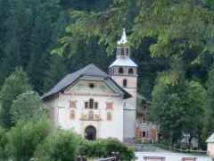
First the GR5 follows a rocky, ancient roman road and passes the chapel
Notre Dame de la Gorge. The road crosses a
roman bridge and leads to the Refuge Nant Borrant.
After 2km is another chalet, Refuge la Balme, both
chalets were completely occupied, so I used the bivouac place for the night.
Refuge la Balme-Refuge de la Balme

Behind the chalets, the GR5 leaves the roman road on a small trail towards
the south. It passes a junction to Jovet lake and the
GR5 climbs up steeply to a plateau. Here is a Tumulus,
to commemorate the death of an english lady and her companion, who were killed
by a violent storm in the 19. century. The path
climbs up the slope in zigzags to the Col du
Bonhomme (2329m ASL/shelter). The GR5 turns left on a rocky path,
crosses small streams and leads to the Col de la Croix du
Bonhomme (2483m ASL). At the Chalet Refuge de la
Croix du Bonhomme (overnight lodgings) the GR5 turns right
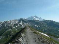
and climbs up to the Crête des Gittes (2525m
ASL). This path was cut into the rocky ridge by soldiers last century. The
path descends to Col de la Sauce and leads over
pastures to the Refuge du Plan de la Lai (water source).
It crosses the road and follows the dirt road, after 1km a small path leaves
the dirt road. It climbs up to the Chalet de la Petit
Berge and the Chalet de la Grand Berge.
The GR5 descends to Chalet des Tréicol
and crosses the slope. It joins the ascending valley track and climbs
up in zigzags. Later, it joins the valley track again. After approximately
1km, the GR5 leaves the track to the Col de Bresson
(2469m ASL). The
CAF-Refuge
at the Lac de Preset (overnight lodgings)
was occupied. Down in the valley is a another chalet, the
Refuge de la Balme Communal, the overnight
lodging is very cheap.
Refuge de la Balme-Refuge de Rosuel

The GR5 descends into the valley, crosses pastures and passes some barns.
It passes Bon Pas and leads through forests downwards. The
path crosses the road to Valezan several times.
In the village is a small supermarket. A small path descends to
Bellentre. After the GR5 has crossed the N90, it turns
right, follows a small path downwards and traverses the
Isère river. There are two choices: You can climb
up the slope via Montchavin or via
Landry. The GR5 follows the road to
Landry, so I used the trail at the bank upstream.
At the bridge I went right, crossed the rails and went into the village.
The GR5 continues briefly on the D87, leads through forests and joins the road
twice. At Moulin, it crosses the
Ponturin torrent and climbs up alongside
the torrent. The lane leads through forests, traverses the river again and
reaches Les Lanches. After about 1km, it passes the
Refuge de Rosuel (overnight lodgings).
Refuge de Rosuel-Refuge de la Leisse

The GR5 leaves the road, climbs up a rocky path and passes a shelter.
It crosses the Ponturin. Now the trail leads through
the Vanoise National Park. The GR5 climbs up to the
Lac du Grattaleu. Behind the lake, the GR5 follows
an ascending path, passes the Refuge du Col du Palet
(overnight lodgings) and climbs up to the Col du Palet.
Here the GR5 leaves the National Park, a lot of cable railways ruins the slopes.
The GR5 leads to Lac des Tignes and to the
Val d'Isère. I left the GR5 and followed the GR55 to
Modane. The GR55 follows the cable railway to the
Col de Fresse uphill, traverses again the boundary
of the National Park and climbs up a rocky path. At Col de
la Leisse the GR5 leads downwards to the Lac des
Nettes, passes the dam at its south end and leads downwards to the
Refuge de la Leisse (overnight lodgings, meals).
Refuge de la Leisse-Refuge Roc de la Pêche

The GR5 descends the Vallon de la Leisse,
traverses at the Pont de Croé-Vie the
Leisse torrent. It climbs up the slope
in zigzags. At the junction to the Refuge
d'Arpont is a memorial for two
Chasseurs alpins who died in the mountain.
The GR55 turns right and follows the ascending path, passes some historical
bunkers and leads to a plateau. It traverses the Ruisseau
de la Vanoise and passes the banks of two lakes. At the
Col de la Vanoise is the
Refuge du Col de la Vanoise (overnight
lodgings, meals). At the pass, the GR55 descends in zigzags, passes the
Lac Long and crosses the marshy
Lac des Vaches on large stones. Later, it traverses
the boundary of the National Park and leads downwards to
Pralognan la Vanoise (supermarket,post office,
camping site,gîte d'étape). The GR55 passes the camping site,
leads through a forest and traverses the Doron torrent at the
Pont de Gerlon. At Prioux
is another gîte d'étape. The GR55 crosses the
Doron again and follows the road to the parking lot. It
traverses the torrent again and follows the ascending dirt road to the
Refuge Roc de la Pêche. The overnight lodging
is very simple but very expensive. At the end of the valley is another hut,
the CAF-
Refuge de Péclet Polset. In 2005, this hut
was burnt down.
Refuge Roc de la Pêche-Modane

The GR55 climbs up the dirt road and leads through meadows, afterwards, the path becomes
stony. It leads up to the Col de Chavière. The
pass is the highest point (2795m ASL) on the GR5/GR55. In early summer,
snowfields are still widespread, so be careful. The stony waymark at the ridge is not
the pass, you'll have to use the small path on the right side.
Behind the pass, the GR55 descends over erroded mountainside. After
approximately 1km, there are two choices: Follow the path left to
the Refuge de l'Orège (overnight lodgings,
junction with the GR5). The trail on the right hand side descends via
Polset. It passes the Source du Vin
(only water :-(). It crosses the road to the
Refuge de l'Orège and joins the GR5. Both waymarks
lead towards Loutraz. The trail crosses the
Arc by a bridge and reaches
Modane (camping site, supermarket, railway station).