Fellering-Chalet-St. Hubert
I took the EC to Mulhouse and the bus to
Fellering.
At Fellering, I followed the waymark blue circle in
direction of Col de Bussang. The path leads into
the valley. I followed the road, it leads to Urbes.
After I passed the village, I followed the waymark red circle, the path
turns left, crosses the N66 and ascends the slope. Beyond, it passes a
bench and a source. At the next junction, I changed the waymark, I followed
the red rectanlge. First, it leads on a forest road, then it ascends in
zig-zag. There is a signpost to the Cuisine de Diable.
The trail gets rocky and steep. After 5min you reach the
Cuisine de Diable, it is a cave in a huge rock. The
trail ascends in direction of the Rouge Gazon. After
it climbs up 200 m vertical, it reaches the Tête de Rouge
Gazon. A path turns left and leads to the Ferme
Auberge. On a dirt road, the GR531 leads in direction of the
Chaume de Neufs Bois. After a few hundred meters,
a small path turns right and leads over pastures. Afterwards, it joins the
dirt road again. It passes the Chaume de Neufs Bois
and some lakes. A small path leads around the Téte des
Neuf bois. Afterwards, the GR531 joins an dirt road and leads to the
Chalet St. Hubert (overnight accommodation). Later
in the evening, a few french hikers hid the Refuge and it began to rain.
Chalet-St. Hubert-Schweissel
The next morning, I followed the GR531 in direction of the Col de Bussang. First, it traverses the slope on a dirt road, afterwards, a small path leads to the pass. You have to climb down a ladder and cross the street. There is a signpost to the Source de la Moselle. But the source had no water.

I ascended on the road in direction of the Drumont.
The road passes a monument and a lake. Afterwards, it joins again the GR531.
A small path ascends the slope. Because it rained the whole night, the
path was muddy. The path leaves the forest and leads through pastures to the
summit. It is a nice viewpoint, the weather was good and I saw the summits of the
blackwood forest and the alps.
The GR 531 descends and passes the Ferme Auberge du
Drumont. It ascends to the Tête de
Fellering and leads downwards to the Col
d'Oderen. The GR531 ascends the slope in zig-zag, passes the
Ferme Auberge Felsach (overnight accommodation and
meals) and climbs up to the Haut de Felsach.
It climbs downwards to the Chaume de Vintergés
(small hut), descends again in zig-zag the slope and leads in direction
of the Grand Ventron. The summit is another
viewpoint. Below the summit is the Ferme Auberge
Ventron (overnight accommodation and meals, but expensive).
I used the tarred road, it traverses the western slope and leads to the
Col de la Vierge. Here is a big shelter and a
monument.

The tarred road leads to the Col de Bramont, here
it joins the GR531 again. It began to rain, the ascending path to
the Col de l'Etang was muddy. The GR531 leads in
direction of the ridge, it passes a road. I left the GR531 and passes
the source de la Thur. The small path reaches the
Route des Crêtes, the road follow alongside the
ridge, it was builed during before the Great War by french soldiers.
Behind the road, I turned right and passes the
Rothenbachkopf and Batteriekopf.
Afterwards, the path reaches a small shelter. I used it as the overnight
accommodation.
Schweissel-Thann
The next morning, it was foggy and cold. I followed alongside the ridge,
afterwards the GR5 joins the ridge. It leads in direction of
Col d'Hahnenbrunnen. The visibility was poor. But
there were a lot of hikers at the path, at the Markstein
were some mountain bikers. The GR5 crosses the road and leads around the
Storkenkopf. Here is the Ferme Auberge le Haag
(overnight accommodation and meals). I ate at the inn.
The GR5 climbs up the slope of the Grand Ballon, it
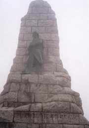
passes a source with a bench. Below the summits is a monument for the French
soldiers, which were killed during the Great War. At the summit is a
ugly radar station.


At the car park below the summit, the GR5 follows alongside the road
and turns left. It leads in direction of la Ferme
du Ballon. It traversses the road twice and leads to the
Firstacker and Col Amic.
The GR5 passes the ruin Freundenstein, it was the
highest castle in the vosges. I left the GR5 and followed the waymark
red/white/red. It passes the Ferme Auberge
Freundenstein and leads around the
Molkenrain. During the Great War, the whole area was
a bloody battlefield, at the Col du Silberloch is a
great cemetery.
The forest road passes the Camp du Turenne, there
joins one the GR5 again. It descends to Thann.