Saverne-Schneeberg
I started the trip at Lorsbach/Taunus.
I took the local train to Frankfurt and changed the
train in Karlsruhe and
Strasbourg. At Saverne,
I left the railway station and went into the city. After approx. 500m you
join the Canal de la Marne au Rhin. At the bridge
is the first waymark red rectangle (GR53). I crossed the bridge and went
alongside the canal. A metal stairway leads up the slope. I followed the
road in direction of car park Bildstoeckle.
 The forest was damaged from the hurricane Lothar. I
had to walk around the fallen trees. After approx. 1km, you join a signpost
to the Haut Barr. The ruin is on huge sandstone
cliff. The castle was builded in the 12. century and owned the bishop of
Strasbourg. It was damaged during the Thirty Years
War by french soldiers.
 At the corner of the car park, the GR53 leads to an old telegraph office.
This tower belonged to the service Paris-Strasbourg.
The GR53 crosses the Hexentisch and a tarred road.
It ascends the slope and reaches the Brotschbergs.
Here is a hut and a observation tower. The path turns left and descends in
zig-zag. It passes the Grotte de Brotsch, a large
cave in a sandstone cliff and reaches the car park Maison
forestière Schaefersplatz. The GR53 leads alongside the road in
direction of Maison forestière Haberacker.
Behind the forest wardner's, the GR53 leaves the road and follows the
forest road. The forest road leads around the
Geissfelswasen. At the next junction is a small
hut. I left the GR53 and followed the GR531 (blue rectancle), after approx.
1km I left the GR531 and followed the waymark red circle. It leads to the
Zollstock. Here you have a nice view to the
the Rocher du Dabo. During middle age, there was
a castle on the summit. It owned to Bruno von
Dagsburg-Egisheim. Later, het got the pope Leo IX. French soldiers
damaged the castle during the Thirty Years' War too. In 1826, a small chapel
was builed. It was rebuilded in 1890. Now it is the St. Leo church.
I crossed the road and followed the waymark red/white/red. It ascends the
slope. At the Col de la Schleif is a new shelter.
I went in direction of Col de Wetzloch and followed
the descending path to Schneematt. The waymark
yellow cross climbs steeply the slope and joins the GR53. I followed the
GR53, below the Schneeberg, it turns right. I followed
the forest road, after approx. 500m I reached the
Refuge. The sun set and some tawny owls cried, a nice
place for overnight accommodation.
You can follow the hole GR53, but it is much longer and it leads down
to Wangenbourg-Engenthal.
Schneeberg-Urmatt
 After breakfast, I went back to the junction with the GR53 and climbed
up to the top of the Schneeberg. The path descends the
slope in direction of Maison forestière Nideck .
It crosses the road and leads to the Châteaux du
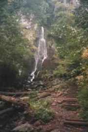
Nideck. A stream falls down in a ravine, at the left side is
a rocky stairway. I climbed down to the ravine and followed the
stream. The GR53 crosses a tarred road and turns left. It leads
in direction of Oberhaslach, passes a camping site and
the Refuge Luttenbach. I left the GR53 and followed
the waymark red triangle. I passed the village and followed the waymark blue
rectangle (GR 531) to Urmatt. There is a railway station, the train drives to
Strasbourg.